Physical Address
The Woodlands, TX, USA
Physical Address
The Woodlands, TX, USA


A prevalent misconception within the discipline is that evaluating celestial partitioning systems requires an insurmountable command of complex algebra. It does not. The underlying mathematics serve a single, foundational function: they act as a stopwatch.
A two-dimensional celestial map constitutes a flattened projection of the intersection between the 360-degree ecliptic and the local horizon. Ascertaining the structural integrity of that celestial map does not require abstract theoretical equations; it merely requires tracking when a specific tropical zodiacal coordinate arrives at a specific altitude and azimuth in our three-dimensional plane of observation. It is a measure of elapsed time, not an interpretative puzzle—a foundational reality that, astonishingly, remains largely absent from contemporary institutional training.
Before practitioners attempt to interpret a flat, two-dimensional piece of paper, they must first cultivate a three-dimensional awareness of the physical sky. The historical foundation of this discipline is strictly observational.
1. The Metrological Demonstration
A. Consider a standard verification test. We select any empty ecliptic coordinate (a tropical zodiacal degree) and calculate its total diurnal arc—the exact amount of time it remains above the local horizon. To verify the structural validity of any given house system (method of coordinate transformation), we must track that coordinate’s displacement after rising.
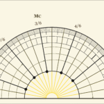
B. For instance, if the full diurnal arc of a specific coordinate measures 1,063.6 minutes (17.72 hours), the coordinate must culminate at the local meridian exactly 50% (or three-sixths) through that arc, or 531.8 minutes (8.86 hours) after geometric rise. If the coordinate system correctly places that specific degree upon the Midheaven (MC) at that precise spatiotemporal milestone, it has successfully measured its altitude and azimuth.
C. However, a valid coordinate method must unconditionally maintain this exact kinematic fidelity across all intermediate stages of ascension.
D. If a system correctly identifies the location (e.g., altitude 0°, Asc; 180°, MC) and the time at which a coordinate rises (e.g., 5:17 a.m.) or culminates (e.g., 2:08 p.m.), but not at which it reaches the twelfth or eleventh cusp (the same time the sun would have had it occupied that tropical zodiacal coordinate/ecliptic degree), the system suffers from a structural flaw: it has failed in the coordinate transformation—that is, it has lost track of the celestial object’s position between the horizon and the meridian. The only framework that successfully tracks these coordinates without deviation, anywhere on the globe, is the Ptolemaic/Placidus system (the “hour-marker method”).
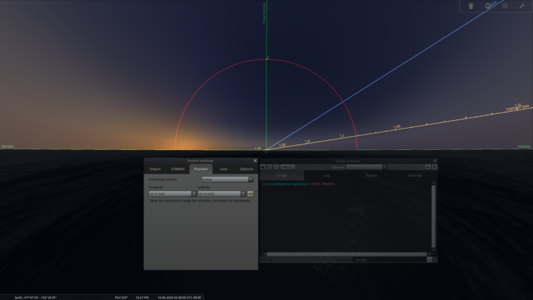
This fidelity can be objectively audited by cross-referencing two-dimensional software, such as Solar Fire Gold, against a three-dimensional astronomical simulator like Stellarium (provided atmospheric refraction and parallax are suppressed in Stellarium to isolate pure geometric ascent). If the 3D altitude and azimuth perfectly match the 2D time after rise, the metrology is sound.

2. The Kodiak Stress Test: An Open Scrutiny
In the accompanying video demonstration, we track a single coordinate, 25º Ge 52’, at a sub-polar latitude in Kodiak, Alaska (57º N). We isolate its exact geometric rise, determine its total diurnal arc, and advance the clock in precise proportional sixths. As demonstrated, the Ptolemaic/Placidus framework never loses track of the coordinate; it arrives flawlessly at every intermediate cusp at the exact required time.
All practitioners are invited to replicate this test in Solar Fire Gold. Establish this baseline in Placidus, and then switch your software calculation to Regiomontanus, Campanus, Alcabitius, or Koch. Advance the clock to the exact same proportional times after rise.
The structural collapse of these models will become immediately evident. The coordinate will systematically fail to position itself upon the subsequent cusps (from one cusp to the next). The framework will assign a different coordinate following each interval, reconciling its measurement solely at the Midheaven. This constitutes irrefutable proof that the system—despite recognising the specific coordinate of interest—suffers a mathematical fracture within the intermediate space and, consequently, lost track of the true physical sky.
For a complete tabulation of these mathematical fractures, refer to the evidentiary appendix of the peer-reviewed kinematic audit, Kinematic Fidelity in Celestial Partitioning: A Topocentric Audit (Correlation Journal, Vol. 38.2, 2026). The published geometric proofs formally document the exact spatiotemporal divergences and coordinate substitutions produced by linear systems during this specific sequence.